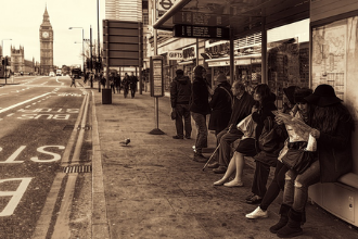
Travelling through London for the first time can be a daunting task due to the fast pace of the city. However, it doesn’t have to be. Plan your route around London before hand and take full advantage of the vast options the city has to offer!
London Maps
Whether you’re travelling around London by Tube, Bus, Overgound, Docklands Light Railway, bike or even on foot, make sure you look over a map before hand:
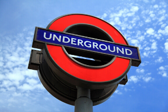
The Tube map is a straight foward simple design, made up of lines naming the stations and services of the London Underground, known colloquially as “The Tube”, hence the maps name. This up-to-date and very straight forward map states all stations which have step-free access, riverboat services, trams, airports and more. This is a must have for any tourist heading to London!
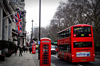
Travelling by bus gets you around London quickly, easily and cheaply. These handy maps will show you each of the bus stop and routes of all buses in Central London and will show you the most efficient way of reaching your destination and a bonus can gaze upon the beautiful sights of London.
Discover the whole of Central London on one networking line. Plan your journey through London with this free map and get the opportunity to explore areas outside of central London. Services go through stations such as Stratford, Euston, Shoreditch High Street, Hampstead Heath, Shepherd’s Bush and Kensington Olympia.
Explore much more what London has to offer, but on two wheels. See the city in a different light and potentially save money at the same time! Find out where to find the Cycle Superhighways, special signed cycle routes and leisure routes that reveal London’s secret gardens and Saturday markets.

Explore the rich history, shopping centres and East London’s famous drinking establishments with the use of the Docklands Light Railway service. The DLR reaches some key destinations, like Stratford (for Westfield Shopping Centre), North Greenwich (for the O2 Arena), Canary Wharf and Cutty Stark (for Maritime Greenwich).
Exploring London’s hidden gems is easy, espescially if you walk. There’s a lot to explore and some great walks connecting them. There are seven routes form the Walk London Network; one of the largest walking networks of any city in the world. These routes are designed to be easily accessible by public transport and you can walk as little or as far as you like.

If you have found it difficult to use London’s public transport, then this is the guide for you. It explains how much easier it is to get around London and encourages the use of of many different forms of public transport. All of the guides can be obtained for free of charge.